Search
Demo Days in Livermore! Join us May 22 or May 23 for in-person demos of the latest technology. RSVP HERE
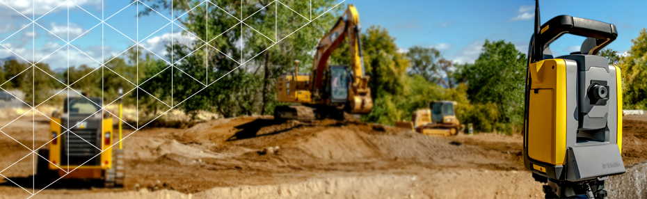
- Trimble SiteVision is a highly accurate augmented reality system that is ideal for outdoor use. It enables you to interact with your spatial data in the context of the real world. You can visualize and measure positions using GNSS and Augmented Reality technology as you explore the project site. SiteVision uses GNSS and a device’s camera and requires the SiteVision app running on a Trimble device…, SiteVision Features and Benefits, SiteVision enables users to easily understand new designs, existing underground services, and how future landscapes will look over time. SiteVision is the ideal tool for multiple industries including architecture, building construction, civil construction and inspection, residential development, urban transportation and planning, and utility projects. Place and view georeferenced 3D models from…, Applications, SiteVision plays a key role in all stages of the construction life cycle and allows you to customize the blended augmented reality/real world view based on the data that is most relevant to your task. Monitor and conduct quality control for earthworks and paving operations Check finished grade and laid material thickness against design elevations and tolerances Confirm designs and avoid issues by…, SiteVision for Key Industries, SiteVision for Utilities Utilities Site Vision for Civil Construction Civil Construction SiteVision for Urban Planning Urban Planning SiteVision for Landscape Architecture Landscape Architecture SiteVision for Residential Construction Residential DevelopmentType: Basic page
- Gain a competitive advantage by being among the first in the industry to offer virtual home showings at 1:1 scale in real environments. Potential buyers can explore models inside and out with interactive tools such as transparency view and cross-sectioning to tour any of your homes more in-depth than if they were in an actual model home. Contact Us , SiteVision Features, Data Support, From concept models in SketchUp, through the detailed design in an Autodesk® AutoCAD® design, to the constructible model in Trimble Business Centre SiteVision works with design models in .SKP, .VCL, .IFC and .DWG formats., Model Positioning, Georeferenced models are automatically positioned, or you can accurately position your model on-site using measurements relative to property boundaries or other site control points. At the pre-feasibility stage, you can manually drag, drop and orient your model., Visualization Tools, Toggle between 2D and 3D views of detailed, fully textured models, section through the streets, services and buildings, adjust the visible layers and level of detail and see real-world comparisons with the transparency slider., Review Your Design, Select different designs to review with just a click. Visualize a design option in its environment and decide whether that is what you want to build or not. Easily present different designs to your clients for them to choose from., Connect Residences, Create the profile of a trench for your house connections, measure the trench alignment and send the design directly to excavators equipped with Trimble Earthworks, Reporting, Take augmented reality photos, measurements and notes with the prospective purchaser on-site and share them for further consideration through Trimble Connect.Type: Basic page
- With interactive, 1:1 scale models that come to life in real environments, you’ll get a true-to-life experience of your design before you break ground. See every detail from garden furniture down to the smallest shrub, visualize how softscape and hardscape elements merge with existing terrain and explore your design from all perspectives—even including shadows. Contact Us , SiteVision Features, On Site Conceptual Design, Engage and interact with your clients in real time creating and reviewing initial concepts on site. Build new concepts on site based on customer requirements using your own SketchUp models or models from the SketchUp 3D Warehouse., Visualization Tools, Communicate design options, growth over time or seasonal effects with your clients—on-site and in real time. Walk them through the landscape to convey the form and space of the design, and its visual impact., Data Support, SiteVision works with models from SketchUp or other design software in .IFC and .DWG formats. Simply load your new design or models from the SketchUp 3D Warehouse into your Trimble Connect project and view on-site., Model Positioning, Georeference your design for automatic placement on site, or measure points relative to existing property lines or other features to place your design in context., Reporting, Share design details and visualizations with clients and contractors using augmented reality photos, site measurements and field notes. Create tasks and assign them to team members, all in real time., Layout, With an augmented reality view available layout of the design is as simple as walking to the points of interest and marking their location on the ground. Use the transparency slider to view your layout points against the design as a simple check.Type: Basic page
- With the visualization tools to overlay design data into real-world settings at true-to-life scale in real time, you can quickly create and communicate a laser-accurate picture of how your plans will come to life. From new intersection designs to road realignments, new bridges and tunnels, SiteVision makes it easy to communicate with all stakeholders. Contact Us , SiteVision Features, Data Support, Visualize all of your planning models—from concepts in SketchUp and feasibility study models in Trimble Quantm to detailed interchange designs from Autodesk® AutoCAD®—in formats you use: SKP, KML, SHP, DWG, VCL and IFC. SiteVision is ready to help communicate your route at any stage of the project., Model Positioning, Georeferenced models are automatically positioned, or you can accurately position your model on site using measurements, relative to property lines or other site control points. At the pre-feasibility stage, manually drag, drop and orient your model on site., Visualization Tools, View fully attributed models, toggle between 2D and 3D views and show proposed changes relative to property lines and other constraints in a real-world view to create a realistic sense of visual impact on stakeholders and the environment., Reporting, Take augmented reality photos, measurements and notes with the affected parties on-site, and share them for further consideration through Trimble Connect.Type: Basic page
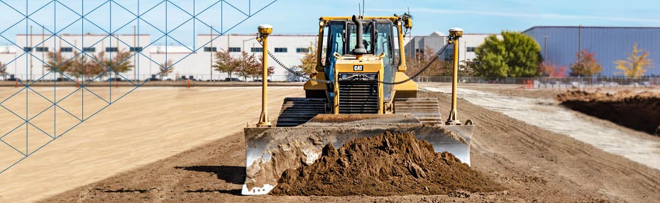
- Whether you’re communicating new designs, changes to field crews, designing temporary works, doing inspections, determining construction productivity, checking grade or recording quick as-built measurements on-site, SiteVision makes understanding the project simple at every step of the process. You can view and share existing designs at any phase of construction or create simple in-field designs…, SiteVision Features, Data Support, Accurately georeference your fully attributed and constructible models from Trimble Business Center (VCL and TTM) using your existing site calibration. Supports third-party design data in LandXML and DWG formats, and shapefiles (SHP) for all your sub-surface utility data from Utility GIS systems., Visualization Tools, Selectively view every element of the constructible model from subgrade to finished surface, with all of the associated services using the layer viewing controls. Compare the designs with the current site by adjusting the transparency. Enable pit view for a better perspective of the depth-accurate subsurface look at utilities, in true 1:1 scale., Cloud Connection, Your crew gets easy access to the latest approved design revision via Trimble Connect direct to your mobile device. Measurements and reporting are automatically sent back through Trimble Connect for simplified data management., Reporting, Capture augmented reality photos, quick measurements and notes to create tasks, report on project status and request clarifications; and then share or assign them to project members, all in real time from the field., In-field design, Measure points on site to create simple in-field designs of trenches, banks, haul roads, retention works or building pads. Visually check the proposed design on site, then upload to Trimble Earthworks to construct the surface. Surface designs are stored for reference in Trimble Connect and future use in Trimble Business Centre. Create and visualize concepts, from traffic management plans to…, Measure, record and inspect as-built, Check grade and earthworks progress. Record the location of as-built services. Inspect completed works and record completed lengths and areas with visual checks. Use augmented reality images to create a record of time, locations and status against design to confirm completion for payment.Type: Basic page
- Replace paint marks and 2D plans with visualizations from high-accuracy augmented reality enabled by Trimble Catalyst technology. With the tap of a button, information is displayed at scale and in context. Take measurements with the integrated distance measurement technology to verify information and fully understand the site. Contact Us , SiteVision Features, Data support, SiteVision supports 2D and 3D data from Esri® databases, digital elevation models, .DWG, .SKP and .IFC data formats. Using SiteVision’s configurable rules engine you can turn existing GIS data into easy to understand 3D models complete with attributes., Measure & Model Positioning, Make real-time calculations and quick decisions with confidence thanks to high-accuracy positioning and measurement tools. Check utility location offsets from property boundaries and occupation by measuring between the real world and the model with GNSS or EDM, or measure the distance between pipes, pylons or valves within your model., Create concepts, Place models from the 3D Warehouse of Sketchup or your own and visualize concepts in the field. For example, see how EV stations will look like when placed in a parking lot., Visualization Tools, Understand and interact with subsurface utility data by using pit view. This enables you to isolate the view of your data in true 3D to compare, validate and plan work on-site by draping it on the ground’s surface and adjusting the diameter and transparency of the data within or outside of the pit., Reporting, Take augmented reality photos and notes in the field, report errors, create tasks and assign them to project members back at the office, all in real time., Plan Construction, Create the profile of a trench where you are going to place your pipes in the field, select the location where it is going to be dug and visualize the trench through your smartphone, then pass the design directly to the machines with Trimble Earthworks to excavate it.Type: Basic page
- Type: External News
- Type: External News
- Type: External News
- Type: External News
